Kategorie:Pläne und Kartenwerke
Zur Navigation springen
Zur Suche springen
(vorherige Seite) (nächste Seite)
Seiten in der Kategorie „Pläne und Kartenwerke“
Folgende 5 Seiten sind in dieser Kategorie, von 18 insgesamt.
(vorherige Seite) (nächste Seite)R
S
W
Medien in der Kategorie „Pläne und Kartenwerke“
Folgende 200 Dateien sind in dieser Kategorie, von 641 insgesamt.
(vorherige Seite) (nächste Seite) 1 Gänsberg-Plan roh Berth. Schützenhof.jpg 5.472 × 4.752; 9,89 MB
 1 Gänsberg-Plan roh Berth.Königstraße 68.jpg 5.472 × 4.752; 9,88 MB
 1 Gänsberg-Plan roh Berth.Mohrenstraße 1.jpg 5.472 × 4.752; 9,87 MB
 1 Gänsberg-Plan roh Berth.Mohrenstraße 10.jpg 5.472 × 4.752; 9,88 MB
 1 Gänsberg-Plan roh Berth.Mohrenstraße 11.jpg 5.472 × 4.752; 9,87 MB
 1 Gänsberg-Plan roh Berth.Mohrenstraße 12.jpg 5.472 × 4.752; 9,88 MB
 1 Gänsberg-Plan roh Berth.Mohrenstraße 13.jpg 5.472 × 4.752; 9,87 MB
 1 Gänsberg-Plan roh Berth.Mohrenstraße 14.jpg 5.472 × 4.752; 9,88 MB
 1 Gänsberg-Plan roh Berth.Mohrenstraße 15.jpg 5.472 × 4.752; 9,87 MB
 1 Gänsberg-Plan roh Berth.Mohrenstraße 16 .jpg 5.472 × 4.752; 9,88 MB
 1 Gänsberg-Plan roh Berth.Mohrenstraße 17.jpg 5.472 × 4.752; 9,88 MB
 1 Gänsberg-Plan roh Berth.Mohrenstraße 18.jpg 5.472 × 4.752; 9,87 MB
 1 Gänsberg-Plan roh Berth.Mohrenstraße 19.jpg 5.472 × 4.752; 9,87 MB
 1 Gänsberg-Plan roh Berth.Mohrenstraße 20.jpg 5.472 × 4.752; 9,88 MB
 1 Gänsberg-Plan roh Berth.Mohrenstraße 20a.jpg 5.472 × 4.752; 9,88 MB
 1 Gänsberg-Plan roh Berth.Mohrenstraße 21.jpg 5.472 × 4.752; 9,87 MB
 1 Gänsberg-Plan roh Berth.Mohrenstraße 22 a.jpg 5.472 × 4.752; 9,88 MB
 1 Gänsberg-Plan roh Berth.Mohrenstraße 23.jpg 5.472 × 4.752; 9,87 MB
 1 Gänsberg-Plan roh Berth.Mohrenstraße 24.jpg 5.472 × 4.752; 9,87 MB
 1 Gänsberg-Plan roh Berth.Mohrenstraße 25.jpg 5.472 × 4.752; 9,87 MB
 1 Gänsberg-Plan roh Berth.Mohrenstraße 26.jpg 5.472 × 4.752; 9,87 MB
 1 Gänsberg-Plan roh Berth.Mohrenstraße 28.jpg 5.472 × 4.752; 9,88 MB
 1 Gänsberg-Plan roh Berth.Mohrenstraße 3.jpg 5.472 × 4.752; 9,87 MB
 1 Gänsberg-Plan roh Berth.Mohrenstraße 30.jpg 5.472 × 4.752; 9,87 MB
 1 Gänsberg-Plan roh Berth.Mohrenstraße 32.jpg 5.472 × 4.752; 9,87 MB
 1 Gänsberg-Plan roh Berth.Mohrenstraße 5.jpg 5.472 × 4.752; 9,87 MB
 1 Gänsberg-Plan roh Berth.Mohrenstraße 7.jpg 5.472 × 4.752; 9,88 MB
 1 Gänsberg-Plan roh Berth.Mohrenstraße 8.jpg 5.472 × 4.752; 9,88 MB
 1 Gänsberg-Plan roh Berth.Mohrenstraße 9.jpg 5.472 × 4.752; 9,87 MB
 1 Gänsberg-Plan roh Berth.Mohrenstraße.jpg 5.472 × 4.752; 9,88 MB
 1 Gänsberg-Plan roh Geleitsgasse 7.jpg 5.472 × 4.752; 8,97 MB
 1 Gänsberg-Plan roh Geleitsgasse 8.jpg 5.472 × 4.752; 8,97 MB
 1 Gänsberg-Plan roh Geleitsgasse 9.jpg 5.472 × 4.752; 8,97 MB
 1 Gänsberg-Plan roh Katharinenstraße 14.jpg 3.258 × 2.872; 5,57 MB
 1 Gänsberg-Plan roh Katharinenstraße 16.jpg 3.258 × 2.872; 5,57 MB
 1 Gänsberg-Plan roh Katharinenstraße 22.jpg 7.258 × 6.399; 31,44 MB
 1 Gänsberg-Plan roh Katharinenstraße a.jpg 3.258 × 2.872; 6,46 MB
 1 Gänsberg-Plan roh Klausengässchen.jpg 7.258 × 6.399; 31,42 MB
 1 Gänsberg-Plan roh Königstraße 42.jpg 7.258 × 6.399; 31,36 MB
 1 Gänsberg-Plan roh Schlezerbergla..jpg 5.472 × 4.752; 9,88 MB
 1 Gänsberg-Plan roh Schulhof 1.jpg 7.258 × 6.399; 31,32 MB
 1 Gänsberg-Plan roh Schulhof 2.jpg 7.258 × 6.399; 31,32 MB
 1 Gänsberg-Plan roh Schulhof 3.jpg 7.258 × 6.399; 31,19 MB
 1 Gänsberg-Plan roh Schulhof 4.jpg 7.258 × 6.399; 31,24 MB
 1 Gänsberg-Plan roh Schulhof 5 1,2.jpg 7.258 × 6.399; 31,24 MB
 1 Gänsberg-Plan roh Schulhof 5.jpg 7.258 × 6.399; 31,26 MB
 1 Gänsberg-Plan roh Schulhof 6.jpg 7.258 × 6.399; 31,23 MB
 1 Gänsberg-Plan roh Schulhof.jpg 7.258 × 6.399; 20,1 MB
 1 Gänsberg-Plan Schlehenstraße 1 1,2.png 3.258 × 2.872; 9,1 MB
 1 Gänsberg-Plan Schlehenstraße.png 3.258 × 2.872; 9,11 MB
 1 Gänsberg-Plan Staudengasse 10.jpg 5.472 × 4.752; 9,89 MB
 1 Gänsberg-Plan Staudengasse 11.jpg 5.472 × 4.752; 9,89 MB
 1 Gänsberg-Plan Staudengasse 14.jpg 5.472 × 4.752; 9,89 MB
 1 Gänsberg-Plan Staudengasse 16.jpg 5.472 × 4.752; 9,89 MB
 1 Gänsberg-Plan Staudengasse 18.jpg 5.472 × 4.752; 9,89 MB
 1 Gänsberg-Plan Staudengasse 2.jpg 5.472 × 4.752; 9,89 MB
 1 Gänsberg-Plan Staudengasse 4.jpg 5.472 × 4.752; 9,88 MB
 1 Gänsberg-Plan Staudengasse 5.jpg 5.472 × 4.752; 9,88 MB
 1 Gänsberg-Plan Staudengasse 7.jpg 5.472 × 4.752; 9,89 MB
 1 Gänsberg-Plan Staudengasse 8.jpg 5.472 × 4.752; 9,89 MB
 1 Gänsberg-Plan Staudengasse 9.jpg 5.472 × 4.752; 9,89 MB
 1 Gänsberg-Plan Staudengasse.6.jpg 5.472 × 4.752; 9,89 MB
 1 Gänsberg-Plan Staudengasse.jpg 5.472 × 4.752; 9,89 MB
 1 Gänsbergplan Stadt Fü Abriss 1956.jpg 6.676 × 4.950; 8 MB
 1 Gänsbergplan Stadt Fü Königstraße 10.jpg 6.676 × 4.950; 7,98 MB
 1 Gänsbergplan Stadt Fü Königstraße 12.jpg 6.676 × 4.950; 7,98 MB
 1 Gänsbergplan Stadt Fü Königstraße 14.jpg 6.676 × 4.950; 7,99 MB
 1 Gänsbergplan Stadt Fü Königstraße 16.jpg 6.676 × 4.950; 7,98 MB
 1 Gänsbergplan Stadt Fü Königstraße 18.jpg 6.676 × 4.950; 7,99 MB
 1 Gänsbergplan Stadt Fü Königstraße 20.jpg 6.676 × 4.950; 7,98 MB
 1 Gänsbergplan Stadt Fü Königstraße 22.jpg 6.676 × 4.950; 7,99 MB
 1 Gänsbergplan Stadt Fü Königstraße 24.jpg 6.676 × 4.950; 7,99 MB
 1 Gänsbergplan Stadt Fü Königstraße 26.jpg 6.676 × 4.950; 7,99 MB
 1 Gänsbergplan Stadt Fü Königstraße 28.jpg 6.676 × 4.950; 7,98 MB
 1 Gänsbergplan Stadt Fü Königstraße 30.jpg 6.676 × 4.950; 7,98 MB
 1 Gänsbergplan Stadt Fü Königstraße 32.jpg 6.676 × 4.950; 7,98 MB
 1 Gänsbergplan Stadt Fü Königstraße 34.jpg 6.676 × 4.950; 7,98 MB
 1 Gänsbergplan Stadt Fü Königstraße 36, 38.jpg 6.676 × 4.950; 7,97 MB
 1 Gänsbergplan Stadt Fü Königstraße 36.jpg 6.676 × 4.950; 7,98 MB
 1 Gänsbergplan Stadt Fü Königstraße 40.jpg 6.676 × 4.950; 7,99 MB
 1 Gänsbergplan Stadt Fü Königstraße 44.jpg 6.676 × 4.950; 7,99 MB
 1 Gänsbergplan Stadt Fü Königstraße 8.jpg 6.676 × 4.950; 7,98 MB
 1 J. Waschenfelder-Plan 1718, Altstadtbläddla 51, 2017-2018.png 998 × 761; 1,52 MB
 1 Lageplan 4 Jahreszeiten 1954.jpg 4.720 × 7.088; 6,02 MB
 1 Lageplan 4 Jahreszeiten Sponsel 1906.jpg 7.940 × 13.950; 12,9 MB
 1 Trost-Plan Altstadtbläddla 51, 2017-2018.png 598 × 813; 411 KB
 1200px-DEU Tutorial - Hochladen von Bildern neu.jpg 1.276 × 652; 290 KB
 1632 Situationsplan.jpg 1.786 × 1.105; 426 KB
 1661.jpg 945 × 627; 1,87 MB
 1663 Finckh Bayern (1).png 507 × 630; 547 KB
 1671 Finckh Bayern.png 487 × 631; 559 KB
 1719 Vetter (2).png 858 × 737; 1,1 MB
 1832 Topographischer Atlas.png 647 × 611; 576 KB
 1896 Stadtplan.jpg 1.725 × 1.395; 269 KB
 1916 Anlage-Weinstraße.jpg 1.417 × 1.330; 832 KB
 1950er-PL-Bayernstr.jpg 800 × 766; 185 KB
 1956 Geologische Karte (Stöckiggraben).jpg 1.728 × 1.752; 1,06 MB
 197011 Plan Aussegnungshalle Stadeln.jpg 2.336 × 3.558; 2,74 MB
 2017 Fuerth Stimm- und statistische Bezirke.jpg 1.655 × 2.340; 481 KB
 20210429 ICE Werk Nuernberg Karte Standorte web-1.jpg 1.170 × 1.170; 251 KB
 772px-Bayern Landtagswahlkreise 2018.svg.png 772 × 708; 221 KB
 A 3164 Heiliggrabkirche 1812 Ausschnitt.jpg 592 × 394; 170 KB
 A 3164 Heiliggrabkirche 1812.jpg 1.263 × 1.008; 883 KB
 Altenberg Alte Veste.jpeg 6.437 × 5.031; 5,76 MB
 Amalien-50 AR 19-8 Plan.jpg 3.219 × 7.473; 2,91 MB
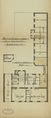
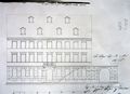 Ansicht des neu zu bauenden Wohnhauses Gartenstraße 9, 1839.JPG 3.264 × 2.360; 1,22 MB
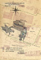
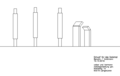 Ansicht Stelen und Bootshaus M 1 zu 35 a.png 589 × 374; 9 KB
 AR 19-32 1.jpg 3.217 × 5.127; 2,07 MB
 Artilleriekaserne 1995.jpg 1.231 × 1.953; 1,16 MB
 Artilleriekaserne 2005.jpg 1.160 × 1.950; 1,07 MB
 Atzenhof Flugplatz Plan 1918.JPG 2.027 × 1.543; 2,99 MB
 Aufriss des Waschhauses, 1839.jpg 1.112 × 1.864; 336 KB
 Aufteilung Grundstück Gran-Leo 1911 Ausschnitt.jpeg 1.233 × 1.232; 486 KB
 Aufteilung Grundstück Gran-Leo 1911.jpg 3.114 × 4.976; 2,89 MB
 Ausländer in Fürth Wohnort.JPG 1.165 × 1.654; 919 KB
 Ausschnitt Stadtwald OpenStreetMap.JPG 1.275 × 671; 178 KB
 Ausschnitt Topographische Karte "Fürth" (GermanyMaps 1954).jpg 1.658 × 1.990; 1,25 MB
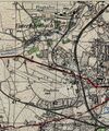
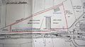
 Bahnhof Vach 1886.jpg 3.455 × 2.048; 1,36 MB
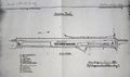
 Bahnhof Vach 1899.jpg 3.577 × 1.233; 847 KB
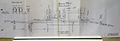
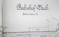 Bahnhof Vach 1925.pdf 1.406 × 893, 9 Seiten; 31,92 MB
 Baierische Monarchie 1830.png 607 × 507; 548 KB
 Baufeld 1900 TV Fürth 1860.jpg 1.528 × 1.455; 1,55 MB
 Baugenehmigung der Regierung von Mittelfranken,3.5.1839.jpg 2.334 × 2.412; 870 KB
 Baugenehmigung der Stadtmagistrats, 6.5.1839.jpg 2.096 × 2.848; 970 KB
 Bauplan 1899 Schneegasse 7 a.jpg 4.932 × 7.392; 22,4 MB
 Bauplan 1899 Schneegasse 7 e.jpg 4.545 × 6.613; 15,13 MB
 Bauplan 1899 Schneegasse 7 f.jpg 4.896 × 5.592; 14,55 MB
 Bauplan 1899 Schneegasse 7 g.jpg 4.919 × 5.680; 10,67 MB
 Bauplan 1899 Schneegasse 7 h.jpg 4.739 × 5.973; 20,84 MB
 Bauplan 1899 Schneegasse 7 i.jpg 4.978 × 6.300; 17,41 MB
 Baupläne Eigenes heim.jpg 2.606 × 5.021; 3,87 MB
 Bauplätze Lerchen-Peterstr 1867.jpg 5.787 × 4.616; 2,93 MB
 Bayern (Finckh) 1662.png 385 × 430; 294 KB
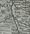
 Belgien 1747 Ausschnitt.jpg 1.709 × 777; 380 KB
 Belgien 1747.jpg 724 × 604; 179 KB
 Bergbräu Kelleranlage 1944.jpg 953 × 1.417; 890 KB
 Bibertbahn 1.jpg 1.966 × 1.761; 1,59 MB
 Bibertbahn 2.JPG 3.121 × 1.517; 1,97 MB
 Bibertbahn 3.jpg 1.905 × 856; 467 KB
 Bibertbahn 5.jpg 2.848 × 1.712; 1,88 MB
 Birkenbunker Bauausführung 1 1000 1942.jpg 2.311 × 1.752; 2,46 MB
 Birkenbunker Planung 1940 - alter Stand Schnitt 1.jpg 5.727 × 1.904; 6,4 MB
 Birkenbunker Planung 1940 - alter Stand Schnitt.jpg 5.887 × 2.215; 6,15 MB
 Birkenbunker Planung 1940 - alter Stand.jpg 6.535 × 4.607; 20,71 MB
 Birkenbunker Planung 1940.jpg 2.451 × 3.509; 3,44 MB
 Btw17 wahlkreise wkr243.jpg 3.510 × 2.482; 713 KB
 Bunker Langfuhrer Straße.jpg 2.480 × 3.507; 1,4 MB
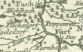
 Burgfarrnbach 1821.jpg 2.500 × 2.460; 802 KB
 Burgfarrnbach Karte 1734.jpg 4.968 × 7.687; 22,34 MB
 Buslinien Fürth 1981.jpg 2.399 × 2.589; 1,89 MB
 Charte von Nürnberg 1800.png 428 × 671; 475 KB
 Comoedienplatz.jpg 709 × 498; 131 KB
 Dambach Housing Area Plan.jpg 11.550 × 8.292; 61,49 MB
 Danzig West Preussen Reichsgau.jpg 640 × 801; 233 KB
 Darby 1995.jpg 3.399 × 1.955; 1,28 MB
 Darby 2005.jpg 3.458 × 2.402; 1,84 MB
 Das Fürstenthum Onolzbach 1791 (Ausschnitt).png 568 × 386; 383 KB
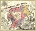
 Das Nürenbergische Gebiet 1730 (Ausschnitt).png 846 × 771; 1,31 MB
 Das Nürnbergische Gebiet 1691 (Ausschnitt).png 787 × 750; 1,18 MB
 Denkschrift O. Holzer - v. Fr. z. St., 1910, Detail Einfriedung.jpg 11.309 × 4.235; 2,92 MB
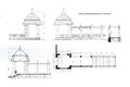 Denkschrift O. Holzer - v. Fr. z. St., 1910, Detail Laubengang.jpg 10.181 × 6.766; 4,9 MB
 Denkschrift O. Holzer - vom Friedhof zum Stadtpark, 1910.jpg 5.102 × 6.750; 10,72 MB
 Die freye Reichsstadt Nürnberg mit ihrem Gebiete 1791 (Ausschnitt).png 746 × 842; 1.022 KB
 Die verfinsterte Erdkugel 1747.jpeg 1.295 × 1.054; 503 KB
 Die verfinsterte Erdkugel Ausschnitt Schneider.jpg 1.828 × 681; 276 KB
 Districtus Norinbergensis 1650-1698.jpg 1.157 × 1.430; 392 KB
 Draufsicht.jpg 1.390 × 1.012; 256 KB
 DSC03186.Wiki.JPG 3.429 × 1.222; 1,01 MB
 Ducatus Baioariae 1766.png 375 × 237; 161 KB
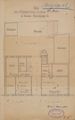
 Engelhardtstr-10 Lageplan 1906.jpg 3.109 × 5.048; 2,14 MB
 Englische Anlage V1.jpg 1.417 × 762; 525 KB
 Englische Anlage V2.jpg 1.417 × 844; 606 KB
 Englische Anlage V3.jpg 1.417 × 879; 602 KB
 Europäischer Luftverkehr 1924.png 726 × 486; 48 KB
 Fach 18 R 7 4.jpg 8.069 × 6.332; 6,01 MB
 Fach 18 R 7 5.jpg 6.464 × 4.286; 3,56 MB
 Fach 18 R 7 6.jpg 9.059 × 6.911; 7,6 MB
 Farrnbach-Überschwemmung Ausschnitt 2.png 1.054 × 616; 463 KB
 Farrnbach-Überschwemmung Ausschnitt.jpg 1.280 × 779; 335 KB
 Flakstellung Höfen April 1945.jpg 1.417 × 1.580; 984 KB
 Flamme Aufklärung.jpg 983 × 824; 582 KB
 Flughafen Atzenhof 1918.jpg 7.512 × 5.853; 9,71 MB
 Flughafenbahn.jpg 1.278 × 2.008; 1,56 MB
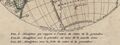
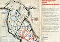
 Flächensanierung Gänsberg Branca-Plan.jpg 9.449 × 3.585; 7,06 MB
 Flößaustr.153 Plan-Waschhaus.jpeg 3.853 × 2.917; 1,39 MB
 Flößaustr.153 Plan.jpeg 3.248 × 2.827; 1,84 MB
 Flößaustr.153 Plandetail.jpeg 3.935 × 2.928; 1,72 MB
 Flößaustr.155 Plan-Rückgeb.jpg 1.575 × 1.083; 676 KB
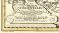
 Franciae Orientalis 1572 (Ausschnitt).png 577 × 273; 290 KB
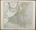
 Frisiae Orientalis 1730 (Ausschnitt).jpg.png 1.099 × 622; 1,29 MB
 Frisiae Orientalis 1730.jpg 1.500 × 1.273; 946 KB
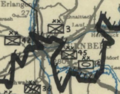 Frontverlauf 19. April 1945.png 621 × 486; 450 KB
 Fusionen Tucher-Bräu.jpg 3.978 × 1.483; 1,22 MB
 Fußgängerzone 1 Preis 2002 Wich.jpg 671 × 1.417; 571 KB
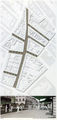
 Fußgängerzone Plan 10.1975.jpg 6.850 × 4.851; 10,48 MB
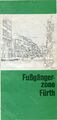 Fußgängerzone Titelseite Plan 10.1975.jpg 2.823 × 5.924; 4,03 MB
 Fäkalienentladestation 1925.jpg 3.619 × 1.988; 2,57 MB
 Fäkalienentladestation 1935.jpg 3.456 × 1.979; 2,36 MB
 Fürth 1630.jpg 1.024 × 688; 370 KB
 Fürth Tag der offenen Tür 13.10.1985 Broschüre.pdf 575 × 1.237, 9 Seiten; 3,97 MB


.png)

.png)


.jpg)


.jpg)


_1662.png)


.png)
.png)
.png)


.png)


.png)
.jpg.png)


